

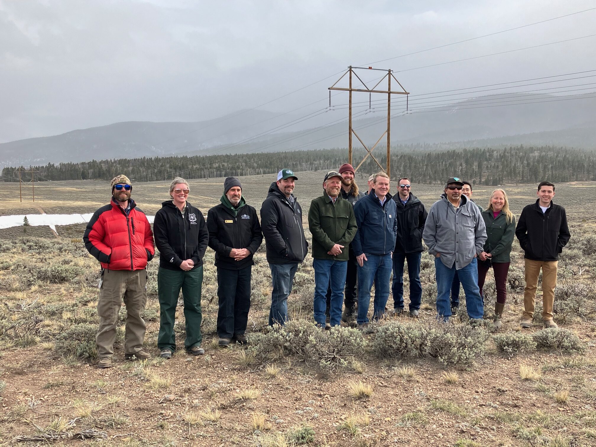
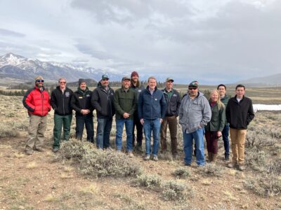
A multi-agency gathering on April 21 provided an overview for U.S. Senator Michael Bennet of the back side of the Poncha Pass Fuels Reduction Project. Photo by Jan Wondra.
Poncha Pass Fuels Reduction Project Makes Progress
A gathering just 50 feet over the Saguache County line from Chaffee County at the top of Poncha Pass on Friday, April 21, included U.S. Senator Michael Bennet, several forest health entities, and energy officials, and demonstrated something remarkable. It highlighted a series of successful collaborations resulting in watershed protection, and improved wildfire mitigation leading to forest health and a strengthened energy grid.
The gathering focused on the Poncha Pass Fuels Treatment project and highlighted the remaining work necessary to protect critical energy transmission lines from wildfire.
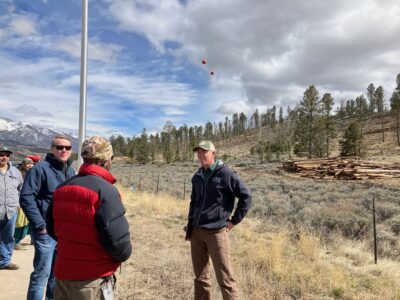
Representatives of the BLM and the CSFS give an overview of the Poncha Pass Fuels Reduction Project for U.S. Senator Michael Bennet during an April 21 event that began at the pass on U.S. 285 and continued to Forest Service roads on the west side of the pass. The lines in the distance marked with orange balloons are the only power source leading into the San Luis Valley Photo by Jan Wondra.
Those assembled to provide an overview for Bennet represented a who’s who of federal and local government staff and elected officials, the U.S. Forest Service (USFS), Colorado State Forest Service (CSFS) , Bureau of Land Management (BLM) and Xcel Energy transmission line asset management.
These are entities are used to working in silos — running programs independently of each other, with program dollars stopping at jurisdiction borders — but now they’re learning how to successfully work collaboratively.
“What we realize is our problems don’t respect jurisdictional lines, the pests, drought issues, wildfires, wildlife recreation management, and our agricultural grazing elements are moving across the jurisdictional lines,” explained Chaffee Commissioner Greg Felt. “We’ve come to realize that we can’t let those restrain us in our vision or groundwork.”
Over the past few years, by combining budgets and resources, and taking advantage of federal initiatives from the “Good Neighbor” program to the recent Federal Infrastructure Act, these formerly siloed agencies discovered that more can be accomplished.
Genesis of the Fuel Reduction Project
Travelers on U.S. 285 over Poncha Pass between Chaffee and Saguache counties used to marvel at the density of the forest. But over the past several years they have seen it die from pest investigation, leaving dangerous stands of dead timber as ready fuel for wildfires. In 2019 the Decker Fire which impacted Saguache, Chaffee, and Fremont counties further convinced local officials that something had to be done. Over the past several months an important project has taken shape — a multi-agency fuels reduction project.
“This has been a team effort. We are truly working cross-boundary to try to manage the forest for the citizens of Colorado the best we can,” said the Southwest Area Manager for the Colorado State Forest Service Damon Lange. Lange led the team, assembling the budget and the cross-agency staffing to make the fuels reduction project possible.
Working with an initial concept of reducing the fuel load on the BLM land in the Poncha Pass area, BLM Rocky Mountain District Regional Fire Management Specialist Scotty Nilson, had a treatment plan. But when his initial idea to do a salvage sale ran into issues (much of the timber was too far gone from budworm to be usable), he turned to the CSFS for help.
The two entities forged an agreement under the Good Neighbor Authority. They soon realized that the land area — a combination of BLM, and CSFS lands and private parcels — needed to be treated as one treatment area because the spruce budworm had damaged trees across the entire area.
The agencies got a $2 million federal match of legislative-delegated funding, and then Governor Jared Polis matched it with another $2 million to complete the treatment.
The pile of logs travelers can see from the road are on private land (the homeowner is retaining the logs) and the next step is a mastication treatment to chew up the leftovers and the smaller trees where the budworm has eaten them.
Then in a few weeks, the crews will literally go “over the hill” on the Poncha Loop; transitioning to treat 110 acres with some congressionally-delegated funds; again a combination of BLM, CSFS, and private lands.

Most power poles in the Poncha Pass Fuels Reduction Project area are wooden poles more than 60 years old This is a rare metal power structure just west of the U.S. 285 pass summit. Photo by Jan Wondra.
Addressing Power Redundancy
While forest health and wildfire danger took precedence, the agencies soon focused on the land area containing the single electric transmission line running into the San Luis Valley.
“This is the only power line going into the San Luis Valley. There is no redundancy yet,” said Saguache County Commissioner Tom McCracken.
He raised not just public safety, but that if there was more transmission, the valley might be able to transition some of their agricultural producers being asked to dry up their land to produce solar power and bring income into the county.
Xcel confirmed that its more than 70 miles of power lines into and across the San Luis Valley are more than 60 years old, and most are wooden. The company has shifted to a wildfire mitigation plan of inspections and treatments; moving from a cycle treatment plan to keep power line areas clear to a more frequent inspection. Drivers seeing the lines crossing over U.S. 285 at the summit see four power lines on the poles: the top two are called “shield lines” protecting against static and lightening strikes. The bottom two carry the power.
Starting on the south end of the San Luis Valley and working its way north, over the next year, Xcel plans to replace all the poles with steel. The company says it plans a bigger conductor to provide more power capacity.
“What would you say to the citizens about what you’ve been able to accomplish here?” asked Bennet.
“I’d say that most people actually don’t realize the benefit of the work we’re doing,” said CSFS staffer Adam Moore, to much rueful laughter. “We have a good partner — it’s a benefit.” He reminded the group that collaboration means that funding can be done as one contract — rather than multiple overlapping contracts, which adds efficiency. “When an incident occurs and they need to get out of the valley, they’ll understand the steps taken to ensure safety.”
Taking the Poncha Loop, a Forest Service road back to the west of the pass brought the group to an expanse of lands that are a mix of federal, state, and private lands and power line right-of-ways. Five separate parcels totaling 110 acres will be treated.
Attention to Watersheds
A view from the next treatment parcel west of Poncha Pass looking eastward across the San Luis Valley and some of the private land parcels in the treatment plan. Photo by Jan Wondra
Most people also don’t realize the importance of protecting the area watershed. Wildfires, mining and other disruptions can pollute watersheds, causing damage locally and hundreds of miles downstream.
Had the 2019 Decker Fire advanced over and along Poncha Pass, most don’t realize that wildfire there would have impacted the watersheds on both sides of the pass. Colorado has seen such damage just in the past few years. The fires in and along Glenwood Canyon along the Colorado River were so damaging that the area has been continuously impacted by mudslides.
The top of Poncha Pass is a genuine watershed: the north descent of the pass drains down to the Arkansas River Valley. The south descent drains into the Rio Grand River Basin.
In fact, says Bennet, the federal funding he and U.S. Senator John Hickenlooper negotiated for the project was specifically approved as watershed protection funding.
Working Across Jurisdictional Lines Toward Shared Goals
“You feel like you’re getting ahead of this?” asked Bennet about the treatment mission.
“When we did Envision Chaffee County in 2017, we did a survey, then ran the CommonGround ballot question. The two highest concerns were affordable housing and wildfire risk — that surprised us,” said Felt. “When Adam Moore says he’s not sure people appreciate it, [in Chaffee] there is a strong perception that we have a tremendous risk. Our community asked back to us, ‘Why aren’t these different agencies better able to work together?'”
“So we asked the same question and at first the answer was murky and siloed,” he added. “But they pulled it together. We’ve got a structure — a community wildfire protection plan.”
Chaffee’s goal is to treat the highest risk 30,000 aces by 2030; one-third of which is on private land. In Chaffee instead of what Felt referred to as ‘random acts of treatment’, “We realized if we treated the top five percent of risk we could reduce the odds of catastrophic risk 50 percent.”
“People often say, ‘Why are you worried about the forest, the forest looks fine,'” said Bennet. “But people just don’t know how dense it’s gotten. The more they see projects like this, they’ll ask about it, and complain about it. But they’ll begin to understand, and how at the county level you’re trying to get ready.”


Recent Comments