
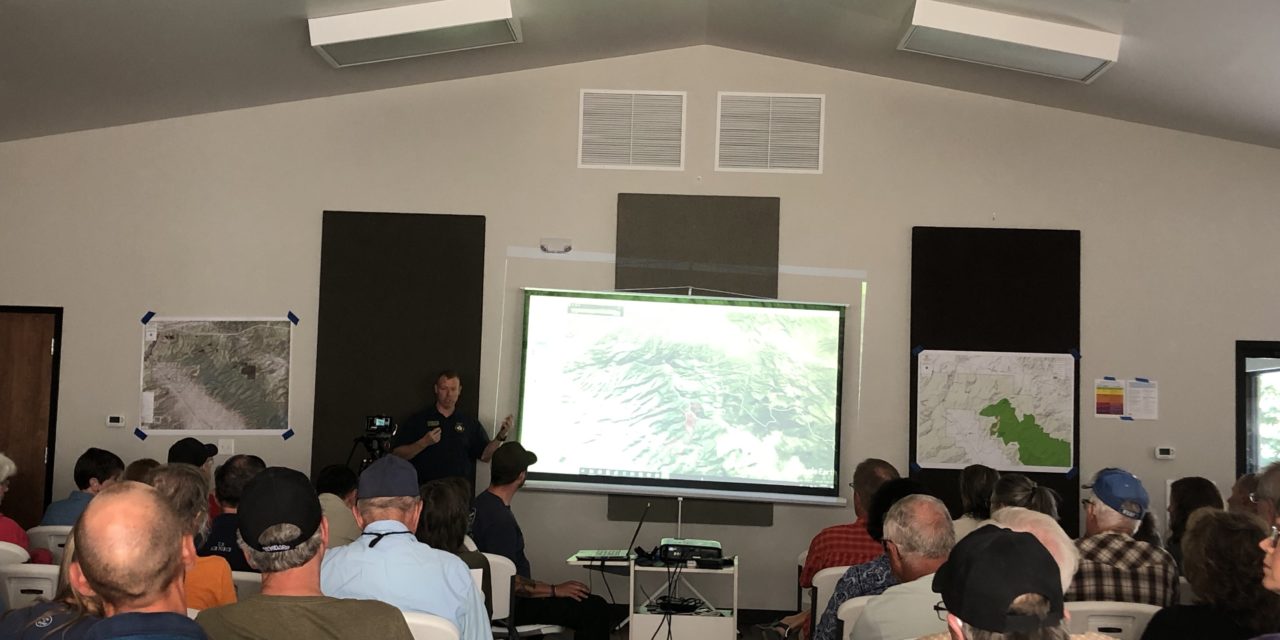

Over 110 people attended a public meeting Sept. 14 at the Poncha Springs Town Hall regarding the Decker fire. Fire managers were on hand to give an update and answer questions. The meeting was also live-streamed and can be viewed on the Decker Fire Facebook page, www.facebook.com/DeckerFire2019.
Susan Fory, Eastern Region public information officer, opened the meeting and presented Incident Commander John Markalunas. He returned to Chaffee County from his role in Cañon City, to manage this fire.
Markalunas viewed the area from Swissvale to Howard in a helicopter Saturday and found “normal” fire behavior. “No large ash was falling, and the ash that was falling was cold,” he said.
“The fire is now seven days old. It started with a lightning strike on the Rio Grande [National Forest] side,” said Markalunas. “It’s remained mostly in the wilderness area where it has lots of fuel from the dead timber due to the [pine] beetles.
“The fire is currently cleaning up that forest. It’s doing good things, and we’re watching its progress,” added Markalunas. He reiterated that this is expected to be a long-term event and that the team they have in place can expand and contract as needed.
Jason Butler, operations section chief, spoke about the day-to-day planning and management. The team has been evaluating the location of the fire and the best way to manage it. They’ll redirect it away from where they don’t want it to go and let it burn elsewhere. They are also evaluating the location of ranches on BLM land and where the communication towers are in relation to the fire. A crew today worked to clear fuel around the communication site on Methodist Mountain. The goal is to have the fire go around the site.
Andrea Holland, air resource advisor, monitors the smoke and air quality associated with the fires. There are two smoke monitor devices in place currently: one in Salida and the other in Coaldale. The Salida monitor will be moved to Bear Creek, and Salida’s will be replaced. Real-time results from the monitors are found on www.wildlandfiresmoke.net/outlooks/CentralColorado.
Holland explained anyone who is in the “sensitive group,” babies, children, pregnant women, those over 60, or people with a heart or lung condition may feel the effects of the smoke and air quality before others. Her advice included listening to your body, drinking lots of water and closing windows at night.
Tristan Post, Saguache District ranger and Jim Pitts, Pike and San Isabel District ranger explained the discussions they have about any fire. When to allow a fire to take its natural path and when they fight a fire. They also consider when it’s too dangerous to try and stop the fire and impacts to the communities. They said that the smoke that is seen in Salida and Poncha Springs might reach Cañon City and possibly Pueblo in the coming days, if not sooner.
Chaffee County Commissioner Greg Felt stated that having Pitts on site together with Markalunas as incident commander is a load off his mind. “We have excellent folks in the Valley who know how to take care of this fire.” He also introduced Rich Atkins, the new Chaffee County emergency manager.
He noted that our current Community Welfare Protection Plan is 12 years old. The county has been working since December to build a next-generation plan.
The plan will better identify priority areas such as controlled burns, managing actual fires and mechanical treatments such as logging and the kind of work being done at Monarch Ski Resort. He fully supports the fire officials as they make tough decisions to work with nature to achieve some real benefits for Fremont, Chaffee and Saguache counties.
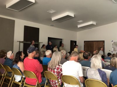
In a lengthy question and answer period, the public was able to ask questions and voice concerns.
It was noted that although residents had received a reverse 911 call a few days ago about the fire, when things changed dramatically over the skies of Salida Sept. 14, a reverse 911 message had not gone out. Richard Atkins explained that reverse 911 messages are not meant to be used for every update. The public could get updates at https://inciweb.nwcg.gov/incident/article/6592/51167/ after 10:15 a.m. each day. Updates also appear on the Decker Fire Facebook page, www.facebook.com/DeckerFire2019.
One man said it would be helpful to have an updated fire map and forecast on the site. He had been evacuated twice in the past and said this would be useful information. Asked, “How long this fire is expected to burn?” The answer was, “until it snows.”
People who live past Howard closer to the fire or near Bear Creek had concerns about whether they should consider mitigation steps to protect their property and/or start to think about evacuation. Officials reiterated that the checks that had been done today showed that the ash that was falling was cold. However, it’s never a bad idea to look at what mitigation steps could be taken. Links to fire mitigation steps can also be found at https://inciweb.nwcg.gov/incident/article/6592/51167/.
One of the final questions concerned spot fires. Chris Nacarrato, the fire management officer, discussed the Multi-Mission Aircraft (MMA) having military-grade infrared that can identify small spot fires. The team then decides to either let those burn, if in the wilderness area or determine if a spot fire needs to be extinguished.
The Decker Fire is divided into two Branches:
Branch I (on the northeast side by Salida) and Branch II (on the southwest side the San Luis Valley). Then subdivided into five divisions.
Branch I - Salida
• Division T (northeast side by Wellsville)
• Division R (north side by Salida)
• Division W (southeast side by Howard)
• Division A (west side by Poncha Pass)
• Division X (south side by Alder)


Recent Comments