

Having debated until nearly 10:30 p.m. last Tuesday, the Chaffee County Planning Commission moved to continue their public hearing on the Aspire Adventure Tours Limited Impact Reviews for an Outfitting Facility, and for Guest and Employee Campground & Camp Cabins, until a date certain, Jan 25, 2022.
The hearing (which actually comprises three limited impact reviews of the proposed commercial recreational proposal) raised issues not just related to traffic and water use, but fielded extensive public comments regarding the proper use of land that is zoned rural. It also discussed the county’s stance regarding commercial activity in unincorporated county areas, as well as what requirements the county can ethically place on business applications when the conditions they are intended to address existed before the proposal was framed.
The week prior, on Nov. 30, the Planning Commission (PC) listened to extensive public feedback from neighbors, a large number of whom said they want the rural character of the county to be preserved without more commercial activity. The PC pointed out that commercial activity is an approved use for unincorporated county land that is zoned rural; in fact that ranches and farms are commercial enterprises.
Midway through the discussions, a straw vote revealed that the PC would require detailed findings and extensive conditions to approve any of the limited impact reviews, particularly regarding the concerns related to water availability and traffic. Not that the PC was negative, only that they considered some of the unknowns to be substantial.
PC Vice-Chair Marjo Curgus said she had thought through several potential mitigations. She began with traffic, although the PC does not necessarily have traffic planning expertise, and the county currently lacks a sufficient transportation road plan and budget to meet the county’s road safety needs as the county continues to grow. She suggested speed bumps.
The proposed site, is situated at the end of CR 191, an unmaintained gravel county road that is not only steep in places, but has a sharp curve. Many neighbors expressed safety concerns and said they wanted something to slow down commercial traffic. It was pointed out that not only is this a pre-existing condition not created by the Aspire proposal, but that most of those who are speeding are, in fact, the local neighbors.
Some on the PC questioned whether it was ethical to require Aspire to provide the solution to an existing traffic problem.
The availability of water in a semi-arid county is always a serious concern. Residential wells within the area are all over the place in terms of well depth. Shallow wells closer to river are in the 200 to 250 ft. depth range. Curgus said that about 10 area wells are in the 40-60 ft. depth range. As you get closer to CR 191, those in the Los Colinas subdivision are 450 to almost 600 ft. deep. “I’m not comfortable saying we can rely on well data to demonstrate water viability for new wells,” added Curgus.
The PC noted that it would be getting recommendations from Colorado Geographic Survey. While the site is flat, it’s adjacent to the river, and could run down into the flood plain. This raised the possibility of integrating more stormwater harvesting and snow impact design techniques to keep water on site.
As the hours ticked by, the PC decided to attempt to frame the findings under which they might consider approval (the conditions section was deemed too complicated to accomplish that late in the evening.)
The pages of findings broke into two general areas: half were related to the limited impact review itself (campground hours/operation plan, future permitting and mitigation on site, and additional development that might be required in the floodplain that would require future permits) and the second group covered aspects of the proposal that are more like traditional subdivision proposals including the well augmentation normally required.
“The applicant has a permit for the domestic well, the exempt well. They are over 35 acres, they do have a permit and they can add water augmentation. You can also have more than one commercial purpose on a property,” said Planning Manager Christy Barton. The well permits come from the state, not the county.
Asst. County Attorney Daniel Tom said that the planning commissioners can take a dual approach to the review and approval of the application: listing outstanding items that need to be resolved as conditions with time frames but don’t need to be addressed yet. County Engineer Gary Greiner weighed in regarding traffic calming and other road issues.
“The other option short of denial is to be careful about issues and conditions – is it possible for them to be mitigated?” said Planning Commissioner Bill Baker. “… it depends upon what we can learn about these conditions…we can’t reengineer the road tonight! If we can’t mitigate, maybe we have to deny. I’m not saying it isn’t possible to move forward, but it depends.”
The group clarified the difference between the typical traffic study the county has required — basically traffic counts — versus an actual traffic impact report — that doesn’t just include traffic levels, but safety, egress, road design, and many things that aren’t yet included in the Chaffee Land Use Code (work has just begun on updating the Chaffee LUC.)
“Our policy is our roads are what they are, we won’t make changes that aren’t already existing roads. It’s a legal policy our attorney wrote up years ago,” said Greiner. “If a resident wants a road improved, it has to come out the deficiency of the road to make it what it was. We don’t make any safety changes.”
The Chaffee policy regarding roads was passed by the Board of County Commissioners in 1993. Neither the county attorney nor the PC has the authority to change it. It was noted that without the county Road and Bridge Department in the meeting, pursuing the topic wouldn’t yield the information needed.
While the PC can require conditions regarding road safety, the majority of the group appeared to think that requiring the entire burden of CR 191 road safety be born by Aspire is inappropriate. “But Limited Impact Reviews allow for mitigation— road safety is one of the impacts that we review for,” Curgus reminded the group.
“We’ve talked safety, speed, this development would potentially increase it, but not cause all of it,” said Tom.
The straw vote revealed a variety of opinions:
“I’d vote to approve, but with significant conditions related to water studies, water quality, water drawdown, and addressing the potential real issues with traffic on this low volume road, which has a blind, narrow, choke point currently being abused by the current users of the road,” said Chair Anderson Horne.
“Having looked through the current comp[rehensive] plan and the code, etc. I do think our county rural areas have a significant number of similar uses, it is consistent with our overarching recreation and tourism goal,” said Curgus.”While sympathetic to community change, it is unrealistic to assume that the county rural zone will only be residential subdivisions.”
“I’d be willing to work on conditions of approval, and I wouldn’t be if I didn’t think there were reasons to approve this,” said Baker. “There are some important issues with the road, water, and impacts, they would have to be addressed in those conditions for me to vote for it.”
“I would say yes with conditions,” said Hank Held.
“I go in the no bucket column right now. I’m very concerned that the rural lifestyle is threatened by this development,” said Planning Commissioner JoAnne Allen.” We are to protect the health and safety of our residents. I would work on conditions for roads, and water. This application is opposed by the Heritage Area Advisory Board. It’s close to the scenic byway.”
“This is an allowed use,” said Planning Commissioner Thomas Dumas. “The intent of the rural zone calls for an impact review, and I take that seriously. We’ve ID’d some real issues that should be mitigated. This puts me in the yes–but category.”
“Clearly this is an allowed use,” said Paul Rauschke. “….but we’ve got a road policy that is 30 years old. Until BoCC updates its plans, we can’t address traffic. And we have to have the water info.”
Over the next hour, the group worked on a draft set of findings that will be finalized in time for the Jan. 25 continued public hearing
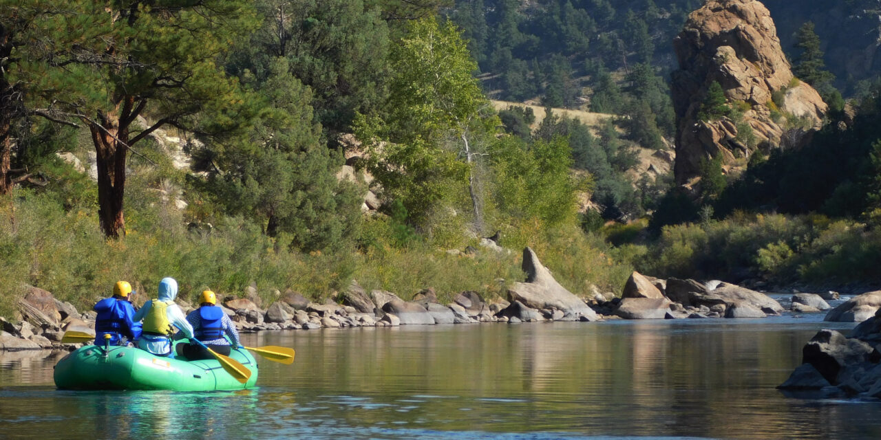
Featured image: Rafters set out from Hecla Junction headed down the Arkansas River. Courtesy image.


This project has to be prevented. As a Smeltertown resident in a 100+ year old home that has been invaded by noise from our hospital, our gravel pit, our increase in traffic on 291, a pot grow and dozens of new residents including our hospital which have camping overnight in RV’s and idling semis and we are no longer able to sleep or have any peace in our own home of 40 years. I can tell you that you have to prevent them beginning or there is not any stopping them and the more you complain the nastier they will get until your home is rendered useless and your rights are gone. Mobbing, though it is not legal is allowed by this county and no homeowner has any rights at all to preserve their quality of life or their life if it is threatened by the noise of others. We do not even have an HVAC system in our home yet we are being run out by the systems of others including non-residents just camping beside our homes to enjoy the area for a few days – 24/7 365. We are already known as a corrupt area and a snobby town here in Salida. It is time to stop allowing the exploiters who came here only to exploit to abuse the residents of this area and to preserve some of our quality of life before you all end up like us or worse, like me waiting to die from seizures due to the noise of others profiting on the harm and my death.