

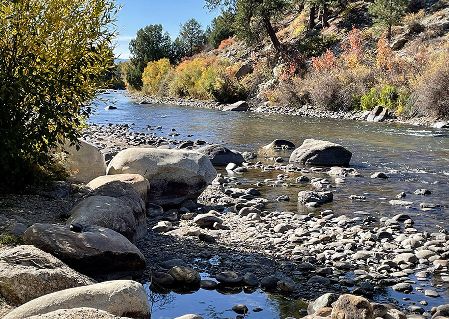

The local stretch of the Arkansas River lost much of its thrill potential Aug. 15, as it does each year when the additional water from the Fry-Ark project is turned off.
The 10,000 acre-feet of supplemental water is traditionally sent into the Arkansas July 1, providing a six-week boost to the internationally known waves that feed the local economy. And while there are increasing questions about how long the arrangement can be sustained amid the ongoing, massive drought in the West, there was enough water this year for the Voluntary Flow Management Program to once again make the Arkansas look bigger than it really is.
Fry-Ark, or Fryingpan-Arkansas, is the trans-basin diversion system that flows out of the Fryingpan River in Pitkin County and is released from Twin Lakes and Turquoise Lake. Its origins are on the increasingly stressed Colorado River. All told, Fry-Ark sends out an average 58,000 acre-feet annually, much of it used in agriculture below the Pueblo Reservoir.

Board of County Commissioners Chair, Greg Felt. Courtesy photo
As of Aug. 22, the Arkansas was measuring 534 cubic feet per second (cfs) at the Wellsville station. The same gage measured 712 cfs on Aug. 1. Chaffee County Commissioner Greg Felt says the current numbers would be closer to 250 cfs if it weren’t for the steady afternoon rains hitting southern Colorado in July and August. He says the precipitation and afternoon clouds have helped keep temperatures good for fish.
Felt, who sits on numerous water boards throughout the state, including a governor’s appointment to the Colorado Water Conservation Board, says that while the additional water is considered supplemental, it’s used thoughtfully and methodically. “It’s cherished water,” he says. “We really get as much out of every drop as we can.”
He credits the Southeastern Water Conservancy District, which was created to administer Fry-Ark, as well as the Bureau of Reclamation and Pueblo Board of Water Works, for working to get the most out of the Fry-Ark waters. Felt notes that up to 20 percent of the flows in the Arkansas have trans-basin origins.
While the rain has changed most of the alarming red zones on the U.S. Drought Monitor’s Colorado map, it hasn’t been enough to significantly affect reservoirs or push back the large-scale drought that began more than 20 years ago. In addition, forecasters say we are likely entering a third year of a La Niña pattern, which signifies a warmer, drier winter in Colorado.
Meanwhile, the Colorado River is making increasingly dire headlines as the levels in Lake Powell and Lake Mead – the country’s largest reservoirs – continue to drop. Lake Mead is posting its lowest levels since 1937, when the reservoir was still filling.
The Colorado River Basin states failed to meet a deadline for emergency drought reduction on Aug. 16, prompting the Bureau of Reclamation to impose new emergency cuts for Mexico, Arizona and Nevada. The Tier 2 shortage conditions means that annual water apportionment to Arizona will be cut by 21 percent, Mexico by 7 percent, and Nevada, 8 percent. Last summer the Bureau of Reclamation issued its historic first cuts that largely affected Arizona farmers, and two months ago, the seven states were told they needed to make emergency plans to curtail water use by 2 million to 4 million acre-feet.
“I guess I’m not surprised,” Felt says, “that 60 days went by and there wasn’t a plan.” He says if anything, the rest of the country, if not the world, now knows about the drought in the West and the pressure on the shrinking Colorado River.
With factors such as hydrology, snowpack, air temperatures, forest health, and soil moisture all at play, Felt says people might want to reexamine their current formulas for drought and acidification. He suggests the trajectories are far more exponential than previously thought.
“It’s not just a simple linear equation,” he says.
Featured image: The Arkansas River is a key player in the Colorado economy. Photo by Tara Flanagan


Recent Comments