
In yet another public open house held on August 30, a crowd of between 50-75 people assembled in the Salida SteamPlant Theater to engage with consultants from the Studio Seed design team working on the South Ark Neighborhood project as well as City of Salida staff. The two-part session was a chance to bring attendees up to date on the latest thinking.
In addition, it brought more clarity to the evolving site plan concepts that aim to provide up to 400 housing units and recreation uses on a portion of the Vandaveer Ranch parcels, between U.S. 50 and County Roads 104 and 107.
Meeting attendees included interested local residents, representatives from the Chaffee Housing Trust, Chaffee Housing Authority, the new nonprofit Places To Age, and the Salida Planning Commission. Mayor Dan Shore, several Salida City Council members, community development and recreation staff were also on hand to hear updates and gauge constituents’ reactions to the latest design options.
Two-part session informs and engages

Cheney Bostic, Principal of Studio Seed addresses South Ark Neighborhood public Town Hall meeting. Merrell Bergin photo
Leading off the evening, Studio Seed Principal Cheney Bostic introduced her team and gave a brief history of the project from inception to its current Phase 3. Complete coverage of this project by Ark Valley Voice can be found here.
The 31-33 acres planned for the South Ark Neighborhood housing and civic uses were shown adjacent to the 63-65 acres set aside for recreation (in what has the working name of the Vandaveer Regional Park).
Bostic outlined how they are approaching the highest and best balance of uses of the site for Salida as a whole.
With teammate Andy Rutz co-presenting, they zoomed in on a few key differences between the two semifinalist site plan concepts last presented to a joint meeting of the Salida City Council and the Planning Commission on July 31.
At that meeting, an informal poll of council members provided mixed opinions but seemed to indicate a tepid consensus for Plan 1A over 1B based on a perception that it would maximize open space on the eastern portion.

Visual and differentiators. Image courtesy Studio Seed
The presentations that night however, together with detailed questions from the audience at this latest meeting, coupled with new 3-D views of the Site Plans (now referred to as #1 and #2, respectively) sharpened the focus for many attendees.

Visual and differentiators. Image courtesy Studio Seed
They helped clarify subtle layout changes made since the last draft, as well as the constraints of recently verified wetlands data.
Interaction intensifies as participants engage one-on-one in the ballroom
The majority of the program kicked in as participants moved into the ballroom. There, large photographs and renderings from the slide show were displayed on easels all around the room. Studio Seed and Salida staff members were stationed in all areas ready to take on detailed questions and primarily to listen to those attending.

Left to right: Chaffee Housing Trust Executive Director Read McCulloch, Chaffee Housing Authority Executive Director Ashley Kappel, Ken Matthews, housing advocate and Abby Peters, Chaffee County Economic Development Corporation review the merits of the two semi-final site plans. Center background, Francie Bomer, Salida Planning Commission Vice-Chair registers her reaction to a comment. Merrell Bergin photo
One area of high interest was the corner where Andy Rutz displayed computerized 3-D and multi-layered view modeling, displaying responses to questions in real-time.
Questions and feedback ranged from aesthetics, trails/connectivity, to highly technical questions about roadway right of ways, drainage techniques, and the economics of the project for funding an estimated initial $7 million in infrastructure costs.
Participants were then each given a single colored dot to place next to their preferred plan as well as provide short written responses to their concerns.

3-D model of site plan 1. Note the large parking areas area and civic placeholder building in the foreground. Image courtesy Studio Seed
By the end of the evening, “votes” for Plan 2 (formerly 1B) seemed to have a slight edge, including 50 more units for a total of 400. Approached by Ark Valley Voice, two council members indicated that new information along with the 3-D views were opening their minds to this option.
Note: 3-D images are shown with all-white exteriors, only for modeling purposes. Standards for actual elevation details, trims, materials and colors are varied and yet to be determined.
Recreation facility desirable but far off and how to fund it?

3-D model of site plan 2. Parking for civic structure and building itself moves eastward adjacent to playing fields. Image courtesy Studio Seed
Participants were reminded that a brick-and-mortar facility (the “purple building”) in the plans for civic/education purposes is a placeholder only, and lacking funding. It could become a recreational facility, a neighborhood school, or even some other civic use — given new revenue or tax sources that would need to be approved by voters.
The immediate question is about where to locate this placeholder so that it has the most flexibility, regardless of any future use decided upon by the community.
Considerations include traffic flow, separation of playing field night lighting/crowd noise, and efficient use of staff while preserving the contiguous neighborhood feel of the housing clusters.
A sample of conversations
As AVV circulated around the ballroom, some snippets of conversations and observations came out. For example, it was noted that the earlier concepts showed a numeric range of possible housing units for each, with significant overlap in the numbers, which also lessened their credibility.

Andy Rutz, Studio Seed consultant (closest to screen) discusses 3-D modeling views of the proposed project. Merrell Bergin photo
The charts that night clearly show an added 50 units in Plan 2, enough to open doors for up to more than 100 additional people needing housing.
The intangible consideration of aesthetics was another consideration. Andy Rutz from Studio Seed confirmed that the orientation angle of buildings in both Plan 1 and 2 is identical.
Comparing the above images in Plan 1, the large “civic” structure and parking lots are prominent. In Plan 2, both are moved to the east of the housing area and are not visually impactful. One person said: “Plan 1 looks like a badly designed suburban office park.”
Local architect and self-admitted housing advocate Bob Grether circulated, outlining three points, that the addition of more housing, strengthens (in his opinion) the case for Plan 2 — and might also address those who advocate for recreation.
- “The recreation [or civic] facility would not be just a neighborhood facility, but rather citywide-serving…It would have better identity as a facility for all residents” he said.
- “…the cost of infrastructure per unit will be reduced along with the cost of housing, making it more affordable.”
- [In Plan 1] If the recreation [civic] facility is not voted in by the city residents and the location is reserved as part of the [core housing] neighborhood, it will leave a hole in that neighborhood and a wasted opportunity for more, well-integrated housing units.”
The multi-million dollar question
It should be noted that full build-out of the project is also estimated to require an additional $7.1 million in infrastructure costs in years five through ten. AVV spoke with Arleen Taniwaki, Principal of ArLand Land Use Economics, whom Cheney Bostic cited as the “key number-cruncher” for the South Ark Neighborhood design project.

Implementation opportunities for South Ark Neighborhood
Taniwaki detailed several of the funding sources shown in the image to the left, that address both housing and recreation.
In addition to grants and partnerships, the city will need to explore the idea of selling some of the land to a developer or working with a developer-builder.
The balancing act: how to attract quality development partners, using conventional project models to generate cash upfront to help pay for the initial infrastructure.
At the same time, the city needs to retain adequate oversight and control the site (ideally in perpetuity) to ensure long-term affordability for the workforce.
Next steps
Studio Seed and city staff will take the input from this town meeting to help refine concepts to bring to work sessions with Salida Planning and Salida City Council, ideally in mid-September. Public comment is sought, as council members are then expected to select a final design in open public session.
Stakeholders should watch the City of Salida meeting calendar for upcoming meetings. The city further encourages constituents to read the packets carefully to prepare, prior to providing up to three minutes of their thoughts during citizen comments at the beginning of each meeting.
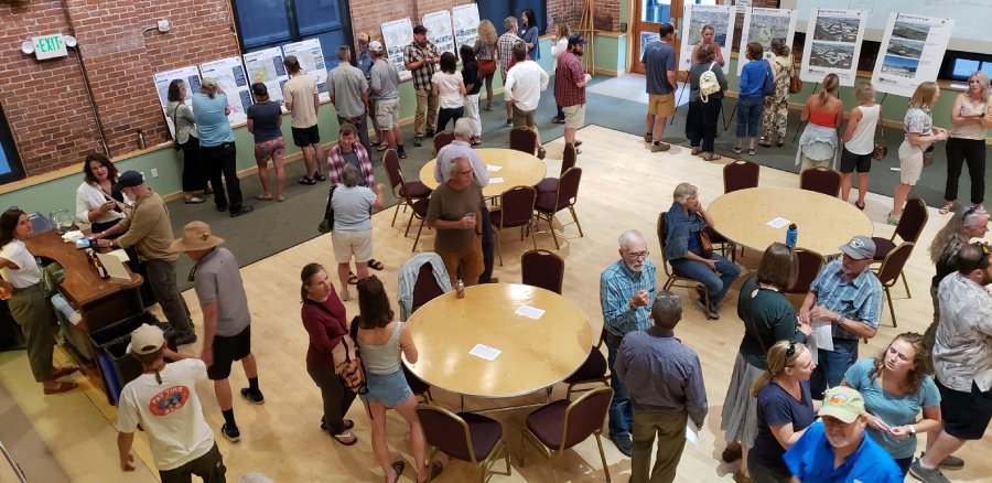
Featured image: View from the balcony at the Salida SteamPlant Ballroom as the South Ark Neighborhood Town Hall is in full swing. Merrell Bergin photo
Editor note: The personal opinions expressed by attendees in this article are just that. There are valid cases to be made for either of the two semi-final plans. The “voting by dots” poll taken is a non-binding, non-scientific snapshot in time, directly impacted by the participants who stayed for the evening. Making your views known to the mayor and your council members is the best way to make an impact on this far-reaching decision for the whole community.


Recent Comments